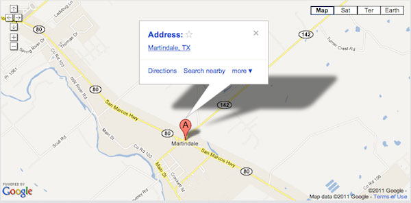
Map & Directions
From Austin:
Interstate 35 Route
South from Austin on Interstate 35 to San Marcos. Exit at Highway 80 (Exit 205 to Luling and Bastrop earlier sign for Exit 205 also says Lockhart) In San Marcos. Turn left (South/East) on Highway 80 under 1-35 past Hastings on left-also "Twins: closest liquor store" on left-and CVS on right). South on Highway 80 though two (3) traffic lights and overpass. About seven (7) miles from 1-35, there Is a blinking yellow light (2-story house on right and cemetery on left, there Is also a sign pointing left to Reedville).
[Note: Speed limit here becomes 55 MPH and becomes 50 MPH as you approach the next traffic signal.]
Just beyond the blinking yellow signal, before the first Sac 'n Pac convenience store there will be a City of Martindale Population sign. Continue on Highway 80, past a Martindale Baptist Church welcome sign and some metal warehouse buildings (one Is the Cottonseed Cafe and Deli) and the second Sac 'n Pac (and Texaco gas station) convenience store at a traffic light at Highway 142.
Just before the Sac 'n Pac and the traffic light, there is a sign pointing left to Lockhart and a sign pointing right to the Post Office. Take a right between the Cottonseed Cafe & Deli and the Sac 'n Pac.
This Is Lockhart Street, which dead-ends Into the Martindale Cemetery at Main Street (Martindale Baptist Church Is on the left and the old Martindale School is on the right). Take a left on Main Street, past the old cotton gin on the right to Downtown (seed silos and a large one-story red brick on the right and metal warehouse building and more seed silos and red brick storefronts on left).
Lockhart Route
South on Highway 183 to Lockhart. Past overpass (with Kreuz Market BBQ (the huge building on the right), the next traffic light is Highway 142. Take a right on Highway 142 West. Go through Lockhart (past the Caldwell County Courthouse on the left) and Maxwell about 9 miles on Highway 142 to the traffic light at Highway 80.
[Note: Speed limit becomes 55 MPH at the City of Martindale sign and becomes 50 MPH as you approach the traffic signal.]
Sac 'n Pac (and Texaco gas station) on the right (and metal warehouse buildings further on to the nght) and a taco trailer on the left across Highway 80. Continue across Highway 80 on Highway 142.
This Is Lockhart Street, which dead-ends into the Martindale Cemetery at Main Street (Martindale Baptist Church is on the left and the old Martindale School Is on the right). Take a left on Main Street, past the old Cotton Gin on the right to Downtown (seed silos and a large one-story red brick on the right and metal warehouse building and more seed silos and red brick storefronts on left).
From San Antonio:
North on Interstate 35 past New Braunfels and Gruene to San Marcos to exit #205 (Bastrop and Luling). Turn right (South/East) on Highway 80 past Hastings on left-also "Twins: closest liquor store" on left-and CVS on right). South on Highway 80 though two (3) traffic lights and overpass. About seven (7) miles from 1-35, there Is a blinking yellow light (2-story house on right and cemetery on left; there Is also a sign pointing left to Reedville).
[Note: Speed limit here becomes 55 MPH and becomes 50 MPH as you approach the next traffic signal.]
Just beyond the blinking yellow signal, before the first Sac 'n Pac convenience store there will be a City of Martindale Population sign. Continue on Highway 80, past a Martindale Baptist Church welcome sign and some metal warehouse buildings (one Is the Cottonseed Cafe and Deli and the second Sac 'n Pac (and Texaco gas station) convenience store at a traffic light at Highway 142.
Just before the Sac 'n Pac and the traffic light, there is a sign pointing left to Lockhart and a sign pointing right to the Post Office. Take a right between the Cottonseed Cafe & Deli and the Sac 'n Pac. This Is Lockhart Street, which dead-ends into the Martindale Cemetery at Main Street (Martindale Baptist Church is on the left and the old Martindale School is on the right). Take a left on Main Street, past the old cotton gin on the right to Downtown (seed silos and a large one-story red brick on the right and metal warehouse building and more seed silos and red brick storefronts on left).
From Houston:
Interstate 10 West past Columbus to Luling. Exit on Highway 90 North/West to Luling. Downtown at the main railroad crossing take a right on Highway 80 and 183. After a couple of blocks Highway 80 then turns left; stay on Highway 80 for about 16 miles to Martindale. (Note: Do NOT continue straight on Highway 163 North).
You will pass through Prairie Lea (speed limit reduced to 50), Stairtown (pronounced Star-town), and Fentress (with a blinking yellow light followed by a little airport on the right featuring as part of Its signage a small plane nose-down In the earth). You will then pass the Highway 130 Toll Road, then a sign pointing left to Staples, and then the Martindale City Limits sign.
[Note: Speed limit here becomes 55 MPH and becomes 50 MPH as you approach the next traffic signal.]
Just before the traffic signal on the left is a Dollar General store, then a taco trailer. Turn left between the taco trailer and the Sac 'n Pac and Texaco gas station. This Is Lockhart Street, which dead-ends Into the Martindale Cemetery at Main Street (Martindale Baptist Church is on the left and the old Martindale School Is on the right). Take a left on Main Street, past the old cotton gin on the right to Downtown (seed silos and a large one-story red brick on the right and metal warehouse building and more seed silos and red brick storefronts on left).